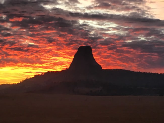
Land Surveying Incorporated
At LSI, we use the latest in leading land surveying and mapping technologies. Our team of experts brings over 30 years of experience and a library of more than 4,000 previously-surveyed sections, ensuring that you get the results you need, every time.
We provide expert services for your project that include the full data collection process from proposal to post-construction. Using state-of-the-art surveying equipment and UAS (drones), we provide comprehensive support from an experienced team.
Our Services
We’d love to work with you on your next project.
Surveying
At LSI, we own state-of-the-art surveying equipment enabling us to complete your project efficiently and accurately. Our staff includes field crews, Professional Land Surveyors, GIS, and AutoCAD professionals, allowing us to provide certified surveys. Our surveying services include:
- A.L.T.A. Surveys
- Boundary
- Cadastral
- Construction staking
- Estate planning
- Infrastructure
- Rights-of-way
- Route Surveys
- Site Layout
- Subdivision
- Topographic
- As-Built Survey
Oil & Gas
LSI works with our Oil & Gas clients throughout the Powder River Basin and Rocky Mountain region providing project, infrastructure, and reclamation analysis and designs that meet regulatory requirements. Our Oil & Gas services include:
- Pipeline Layout
- Platting
- Utility Surveys
- Well Pad Design and Facility Layouts
- Well Staking
- Grading Plans
GIS/CAD
Our employees use the latest versions of AutoCAD Civil 3D and ESRI ArcGIS software and have access to an extensive data infrastructure to quickly and accurately retrieve previously surveyed data for use on projects. This effectively reduces drafting and mapping time, which allows us to deliver the same quality at a lower price to our clients. GIS / CAD services include:
- Well plats
- Surface use plans
- Geodatabases, preliminary and as-constructed
- Reclamation plans
- Landowner maps
- Access road/roddage calculations
- Alignment Sheets
- As-built drawings
Drones (UAS)
Drones, also referred to as unmanned aerial systems (UAS), are equipped with GPS technology and a high-resolution camera. With this system, we’re able to offer a new approach to the following:
- Environmental surveys (including vegetation mapping and reclamation surveys)
- 3D modeling of features
- High-Resolution imagery (aerial photos)
- Topographic surveys and contour maps
- Recorded videos
- Marketing
- Construction Services (including progress reports, open ditch pipeline status updates and roads and highway services)
- Site facility/site security diagrams
- Volumetric Analysis
At LSI we combine our passion and expertise, leveraging our many years of experience, which allows us to deliver the best returns on your time and investment.
Regardless of the scale of the project and its complexity, we’re able to deliver a successful outcome on time and within budget.
Rigorous Safety Training and a Proactive Approach to a Safe Workplace
For increased operational efficiency and optimal performance.
Land Surveying Incorporated has a premier reputation for construction safety and health, which is fostered through management commitment and a comprehensive safety program. This includes a formal safety organization, manuals, written policies and procedures, pre-employment screening, training programs, anti-drug and alcohol programs.

About LSI
Land Surveying Incorporated has been in continuous operation for over 28 years. The company was established in 1991 by Don and Ann Brady. They were joined in 2000 by Cevin Imus, who became a business partner in 2001. In January 2007, Cevin and Stacy Imus became the new owners of Land Surveying Incorporated.
They are committed to offering the same high standard of work and reliable services that clients have come to expect.
Why us
An Industry-Leading Experience with Land Surveying Incorporated
We’re a Gillette-based company specializing in surveying, GIS, drafting, and UAS services utilizing cutting-edge technology.
- A locally owned and operated business
- Competitive pricing
- Quick turnaround times
- Free quotes
Licensed in Wyoming, South Dakota, Montana, and Nebraska
Members Of:

![]()

![]()
Quality · Honesty · Flexibility
Technologically advanced solutions from a passionate, customer-focused team.With a forward-focused approach, Land Surveying Incorporated prioritizes quality solutions that consistently and reliably offer accurate services to our clients using the latest technology. We operate to the highest ethical standards and work with flexibility to meet the requirements of clients and stakeholders.
Ready To Talk?
To find out more about what we can offer your business, please fill out our contact form or give us a call at 307-682-1661.