Land Surveying Incorporated
209 N. Works Ave.
Gillette, WY 82716
(307) 682-1661
Call Today!
209 N. Works Ave.
Gillette, WY 82716
Call Today!
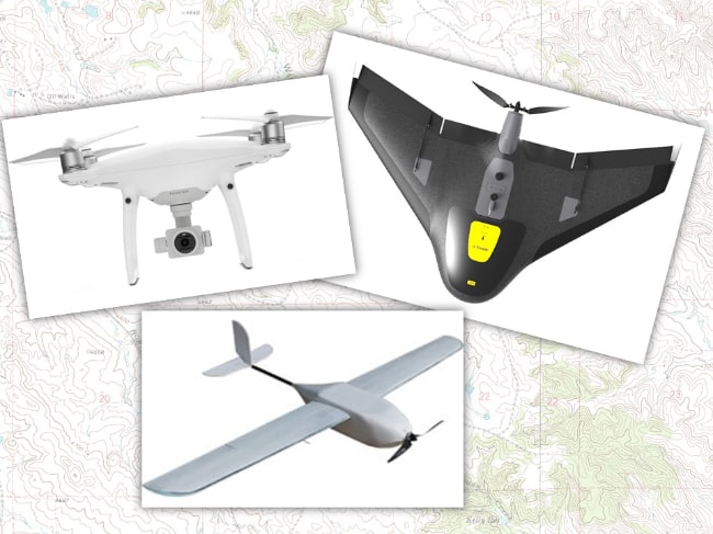
LSI continues to innovate and lead the surveying industry by offering drone (UAS) services. We have multiple qualified UAS Remote Pilots on staff and a variety of different drone platforms to suit your project needs. Each platform has a specific purpose and can be used as a tool to collect data in a safe, efficient, and reliable manner. Drones allow us to cover a large area and collect high volumes of data in a short time.
Drones not only complement our existing land survey instruments, but they have also allowed us to expand our list of services that we can provide our clients and our community.
We pair our drones with the latest in survey equipment to provide you with imagery up to 1-cm per pixel resolution and survey-grade surface modeling with elevations accurate to +/- 6 inches.

Utilizing drones we are able to complete your project quickly, safely, and in some cases more accurately than with ground-based surveying alone. Aerial surveys allow our surveyors to see the whole picture and deliver a better end product for our clients.
Our drone platforms allow us to take your land management surveying to the next level. We can survey the entire area and deliver results that other methods can not.
Aerial surveys allow contractors to generate virtual environments as well as the ability to Geotag images and develop extremely accurate site maps.
Our drones have many applications in the mineral and energy industries, including infrastructure inspections, surveying and mapping, geotagging, volumetrics, as-built, and emergency response.
High-resolution maps, surface models, and detailed recorded flyovers for review by archaeologists off-site can all be delivered using our drone platforms.
Drones allow us to record videos and aerial photographs to promote your business or event.
Drones, also referred to as unmanned aerial systems (UAS), are equipped with GPS technology and a high-resolution camera. With this system, we’re able to offer a new approach to the following:
Contact us and let’s discuss your project.
Land Surveying Inc. ©2024 All rights reserved
Made By Prairie Giraffe.